Where Is Nantes
Nantes is in western France, the prefecture of the Loire-Atlantique department in the Pays de la Loire region, on the Loire river where the Erdre and the Sèvre Nantaise join it. Here is exactly where it is, how far it is from everywhere else, and how you get there.
Short answer
Nantes is a city in western France, in the Loire-Atlantique department of the Pays de la Loire region, standing on the Loire river at the point where the Erdre and the Sèvre Nantaise meet it, roughly two hours from Paris by TGV.
Nantes is a city in western France, the prefecture of the Loire-Atlantique department within the Pays de la Loire region, standing on the Loire river at the point where the Erdre and the Sèvre Nantaise join it. That single sentence answers the headline question, but the honest answer is richer than a map pin. Nantes sits near the head of the Loire estuary, roughly two hours from Paris by fast train and under an hour by regional train from the Atlantic beaches of La Baule and the fishing port of Le Croisic. It is a city of 327,734 people in the commune proper, the largest urban centre in France's west, and a place whose regional identity, Breton in history and Pays de la Loire in administration, is a live argument among the people who live there.
This page lays out the geography properly: the region and department, the rivers, the distances, the climate as the Météo-France station actually records it, and the practical routes in by air and rail. For the fuller sightseeing picture, the site's main Nantes experiences round-up covers what to do once you have arrived, and the history of Nantes explains how the city on this spot came to matter so much.
Where Is Nantes On The Map Of France?
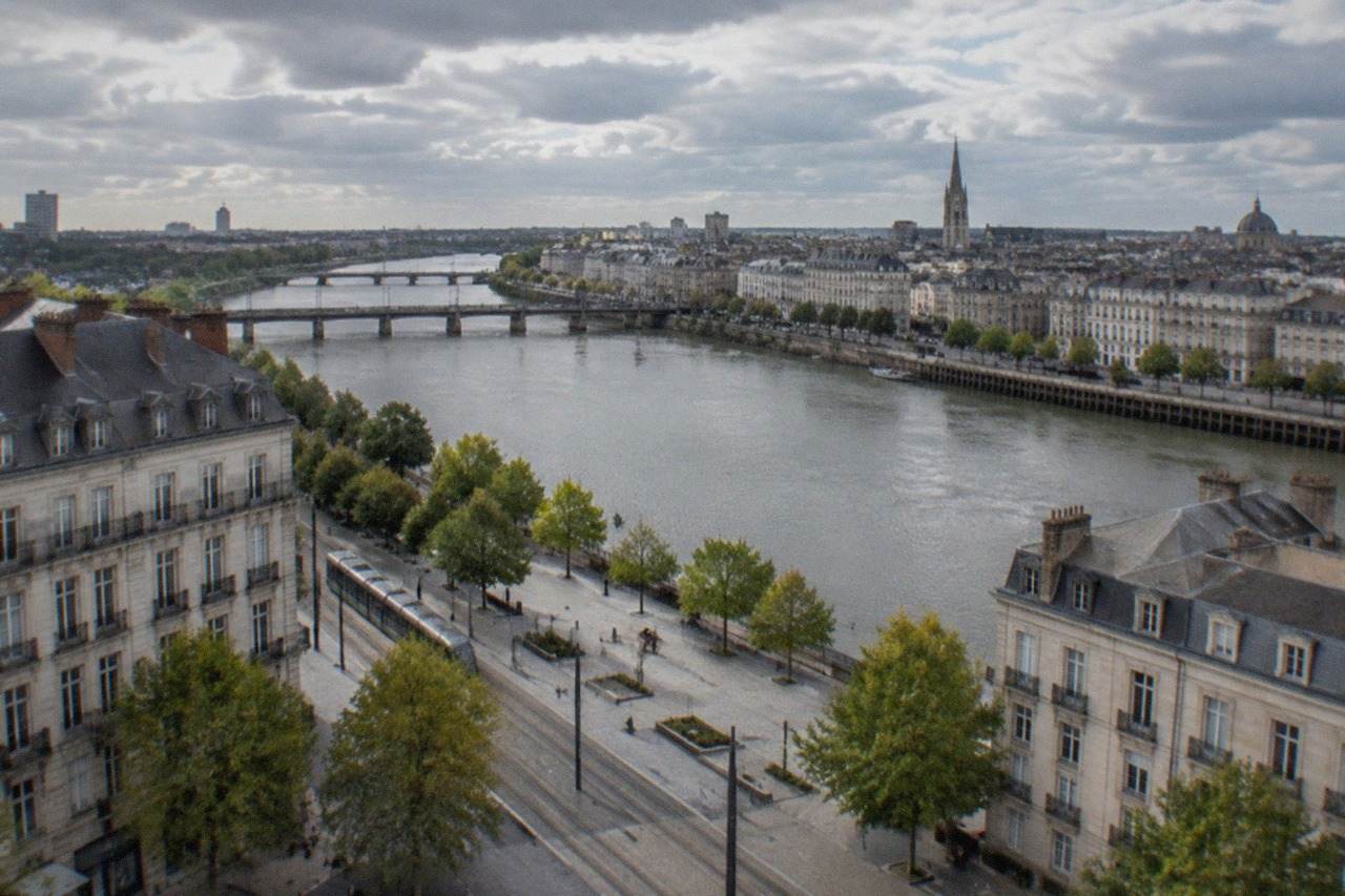
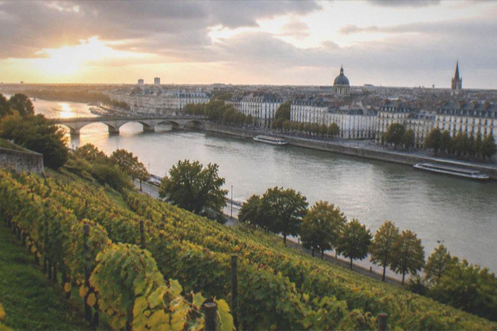
Nantes sits in western France, in the Loire-Atlantique department of the Pays de la Loire region, where the Loire river approaches the Atlantic. The city stands at the meeting point of the Loire and its tributaries the Erdre, which joins from the north, and the Sèvre Nantaise, which joins from the south. It is France's sixth most populous commune and the largest urban centre in the west of the country.
If you picture France as a hexagon, Nantes is in the lower-left corner of it, inland from the Atlantic coast but not far inland at all. The Loire, France's longest river, runs through the city on the final stretch of its journey to the sea at Saint-Nazaire, some 64 km away by rail. That estuary position is the whole story of the place: ocean-going ships could once reach the city, and everything that made Nantes rich, from ducal Brittany's capital to France's biggest slave-trading port to a shipbuilding and biscuit-making industrial centre, followed from that fact.
The immediate surroundings matter too. To the south and east lie the Muscadet vineyards of the Sèvre Nantaise valley, where the 2026 grape harvest began on 11 August, a record eight days earlier than the previous mark. To the north the Erdre winds through wooded country that locals call the river's finest stretch, and to the west the Loire broadens towards Saint-Nazaire and the coast. If you are planning a trip around the region, the guides to day trips from Nantes and Nantes and the Loire Valley by road build on this geography directly.
Which Region And Department Is Nantes In?
Nantes is the prefecture of the Loire-Atlantique department, which belongs to the Pays de la Loire region, one of France's administrative regions. The department was called Loire-Inférieure until it was renamed Loire-Atlantique on 9 March 1957, and it was administratively separated from Brittany by a decree dated 30 June 1941. Nantes is therefore governed as part of Pays de la Loire, though its history is deeply Breton.
The region around Nantes is Pays de la Loire, a grouping assembled in its modern form from five departments: Loire-Atlantique, Maine-et-Loire, Mayenne, Sarthe and Vendée. The name of the department is always written with its hyphen, Loire-Atlantique, because that hyphen is part of the official name. The city is the department's prefecture, its seat of administration, and the region's largest city, which is precisely why the 1941 separation still stings: the 30 June 1941 Vichy decree attached Loire-Inférieure to an Angers-centred region, cutting the historic ducal capital out of Brittany's administrative body, and no post-war government ever fully reversed it.
For a modern visitor the distinction is mostly a matter of how you label your trip. Local tourist bodies market the city jointly as Nantes, Saint-Nazaire and the surrounding estuary country. Whether the city "belongs" to Brittany is argued in bars and regional councils alike; the full story, from Anne of Brittany to the 1941 decree, is told on the page is Nantes in Brittany.
How Far Is Nantes From Paris And Other French Cities?
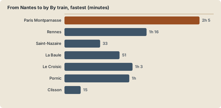
Nantes lies about two hours from Paris by direct TGV, with roughly 24 trains a day in each direction and the fastest services completing the run in around two hours and five minutes. Nantes to Rennes takes about 1 hour 16 minutes at best by regional train. The city sits some 64 km by rail from Saint-Nazaire on the Atlantic coast, and the Atlantic resort of La Baule is around 51 minutes away by TER.
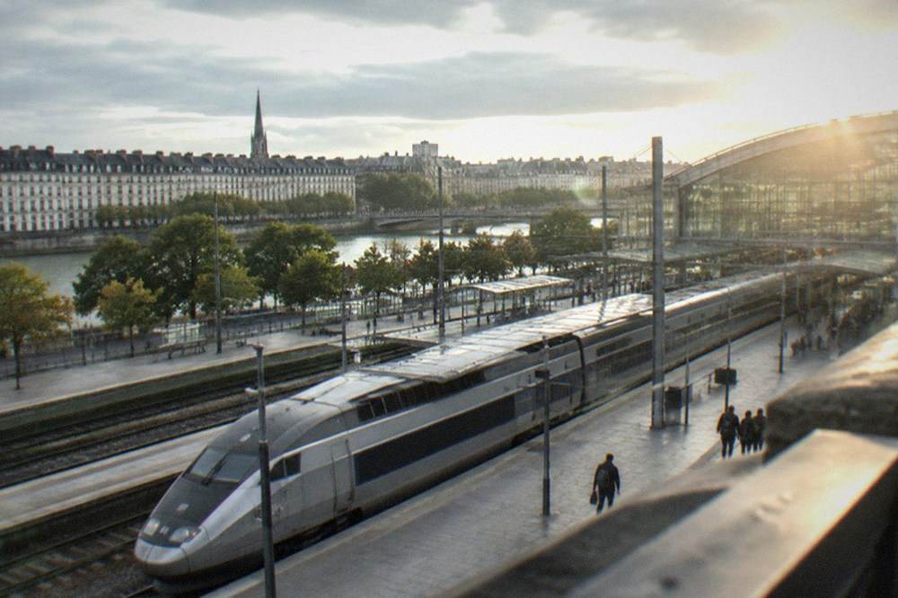
The Paris connection is the spine of Nantes's accessibility. SNCF's published timetables show about 24 daily services each way between Nantes and Paris, most of them direct to Montparnasse, with the fastest around two hours and a handful of OUIGO fares that can start near €10 if you book early. Day-tripping to Paris from Nantes is realistic; doing it comfortably is a matter of catching one of the morning directs. The full how-to, including station detail and booking tactics, sits on the Paris to Nantes page.
Westward, the rail lines follow the estuary and the coast. The table below gathers the journeys the figures cover; the driving times are approximate road figures from route planners, and the rail times are the fastest published connections, not the average.
| From Nantes to | By train, fastest | Road distance |
|---|---|---|
| Paris Montparnasse | about 2 h 05, ~24 services/day | not in the verified pack |
| Rennes | about 1 h 16 by TER | not in the verified pack |
| Saint-Nazaire | about 33 min by TER | 64 km by rail |
| La Baule | about 51 min by TER | not in the verified pack |
| Le Croisic | about 1 h 03 by TER | not in the verified pack |
| Pornic | about 1 h by TER | not in the verified pack |
| Clisson | from about 15 min by TER | 27 km by rail |
| Guérande | not in the verified pack | about 80 km by road |
| Puy du Fou | not rail-connected | about 70-80 km, ~1 h drive |
| Mont-Saint-Michel | not rail-connected | roughly 2 h 15 by road |
Clisson is worth flagging because the Pass Nantes, the city's tourist pass, includes one TER return journey to Clisson within its price, along with unlimited Naolib transport and one airport-shuttle return. That combination, a castle town in Italy-inspired stone under half an hour from the city centre, is one of the easiest geometry lessons the region offers: Nantes is close to everything on its own side of France. Current pass prices and what they include are set out on how the Pass Nantes works.
What Rivers Flow Through Nantes?
The Loire is Nantes's great river, flowing through the city on its way to the Atlantic, with the Erdre joining it from the north and the Sèvre Nantaise from the south. The Erdre is the locals' favourite, a slow, tree-lined river with boat cruises and parkland banks inside the city, and the historic Île Feydeau district, the former ducal port and the island where Jules Verne was born in 1828, sits on the Loire itself.
Three watercourses define the map. The Loire arrives from the east, gathers the Erdre at the north of the city centre and the Sèvre Nantaise to the south, and carries on west towards the estuary. The Erdre, which rises deep in the countryside towards Anjou, is navigable and pretty; a three-hour cruise aboard the Na Boa boat is one of the listed products on this site, and the Île de Versailles, a Japanese garden set on an island in the Erdre, is one of the city's free, quiet corners. The Sèvre Nantaise drains the Muscadet country to the south-east, the vineyard belt around Vallet where the Maison des vins de Muscadet is based.
The rivers also shape how the city is laid out for a visitor. The Île de Nantes, the long island in the middle of the Loire, is where the former shipyards became the Machines de l'île and the Hangar à Bananes. The Loire's floods are a live feature of the geography, not a historical footnote: February 2026 brought the river to 8.18 m at the Pont Anne-de-Bretagne, the first reading above 8 m in about fifteen years, closing riverside roads and even the Mémorial de l'abolition de l'esclavage, whose own practical page warns it closes during Loire floods.
Walking the riverside on your own works, but the geography is easier to decode with someone who can point at it. Check availability for a private custom walk and let a guide connect the rivers, the islands and the old port into one picture.
| River | Direction it joins from | What it gives Nantes |
|---|---|---|
| Loire | from the east, to the Atlantic west | the historic port, Île Feydeau, Île de Nantes, the estuary route to Saint-Nazaire |
| Erdre | from the north | riverside parkland, the Île de Versailles Japanese garden, cruise and boat activity |
| Sèvre Nantaise | from the south-east | the Muscadet vineyard belt and the Vallet wine country |
Is Nantes In Brittany?
Historically yes, administratively no. Nantes was a principal residence of the dukes of Brittany, Anne of Brittany was born at the Château des ducs de Bretagne in 1477, and the Edict of Nantes was signed there in April 1598. But the department has been administratively separated from the Brittany region since the decree of 30 June 1941, and present-day Nantes is governed as part of Pays de la Loire.
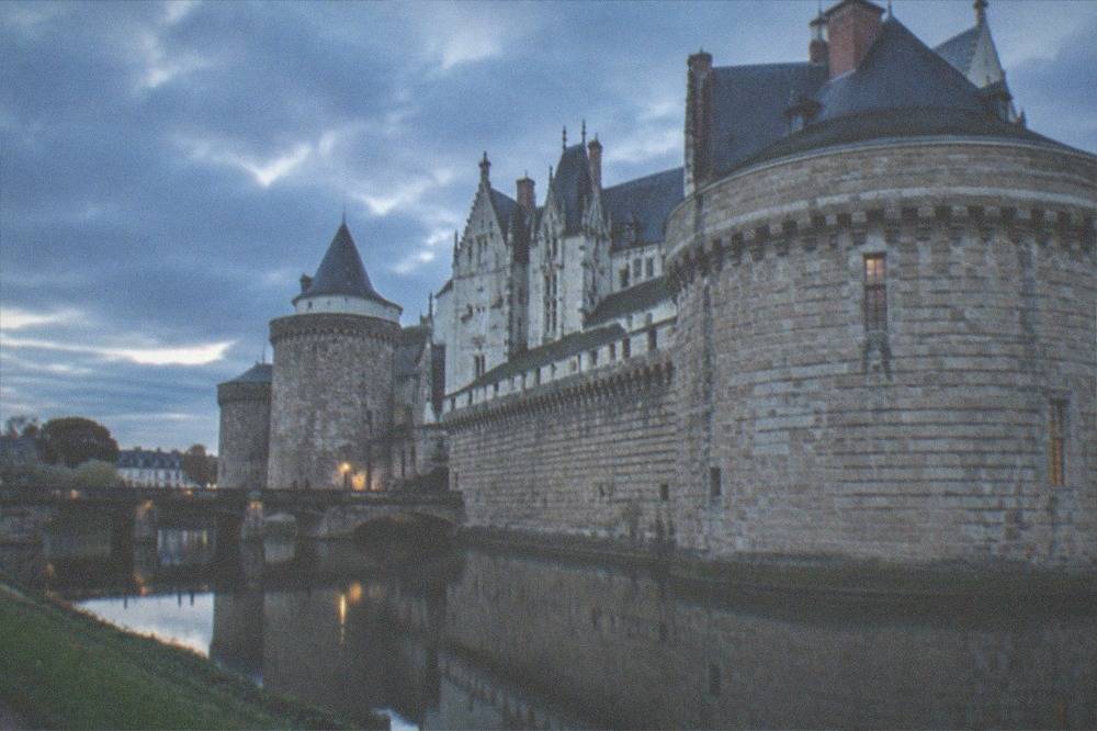
The ducal evidence is everywhere in the city's stones. Francis II began rebuilding the Château des ducs de Bretagne in 1466, and his daughter Anne, born there on 25 January 1477, would become duchess of Brittany and twice queen of France before dying at the Château de Blois on 9 January 1514. The union of the duchy with the kingdom of France in 1532 is the hinge date; the Edict of Nantes, signed by Henri IV at the château in April 1598, is the event that put the city's name into every European history book, and the château's own page dates the signature to 30 April 1598. The full index of guides sits on Nantes Travel Guide.
The modern argument is a borders argument. Breton regionalists treat Loire-Atlantique as Brittany's fifth department and its natural capital; French administrative maps place the city in Pays de la Loire and have since the post-war regional settlement. Nobody disputes the history, and the Museum of history inside the château, with more than 1,150 objects across 32 rooms, tells all of it, including the hardest chapter: between the mid-17th century and 1830, Nantes fitted out 1,714 slave-trade expeditions, 43% of the French total, a history documented in depth at the Mémorial and on the site's Nantes slave trade history page.
What Is The Weather Like In Nantes?
Nantes has a temperate oceanic climate, not a Mediterranean one. Météo-France's 1991-2020 normals for the Nantes-Bouguenais station give a mean daily maximum of 9.3°C in January rising to 25.4°C in August, with 819.5 mm of rain a year spread across 119.7 days. Days reaching 30°C average 11.8 a year, frost touches 29.1 days a year, and the station records 1,873.3 hours of sunshine annually.
The oceanic label means mild, damp winters and warm, not scorching, summers, with rain possible in any month but no dry Mediterranean summer. December is the wettest month at 101.0 mm and October and November follow close behind; July is the driest at 44.2 mm. The warmest month by mean temperature is July at 19.7°C, the sunniest is August at 232.6 hours. What this means for planning is simple: shoulder seasons work well, summer is reliable without being Greek-island hot, and a light rain layer earns its place in the bag most of the year.
| Month | Mean max °C | Mean °C | Rain mm | Sunshine h |
|---|---|---|---|---|
| January | 9.3 | 6.4 | 87.9 | 72.6 |
| April | 16.2 | 11.4 | 58.3 | 182.7 |
| July | 25.1 | 19.7 | 44.2 | 229.0 |
| August | 25.4 | 19.8 | 50.3 | 232.6 |
| October | 17.6 | 13.5 | 88.8 | 122.7 |
| Year | 17.1 | 12.7 | 819.5 | 1,873.3 |
Recent years have bent the record book. The station's all-time high is now 42.2°C, set on 24 June 2026, with the previous record of 42.0°C from 18 July 2022; August 2026 set its own monthly record at 40.4°C and May 2026 at 35.7°C. None of that makes the climate continental or Mediterranean; it makes 2026 the hottest stretch the station has measured since records began. For month-by-month planning advice, see Nantes weather and the best time to visit Nantes.
How Do You Get To Nantes?
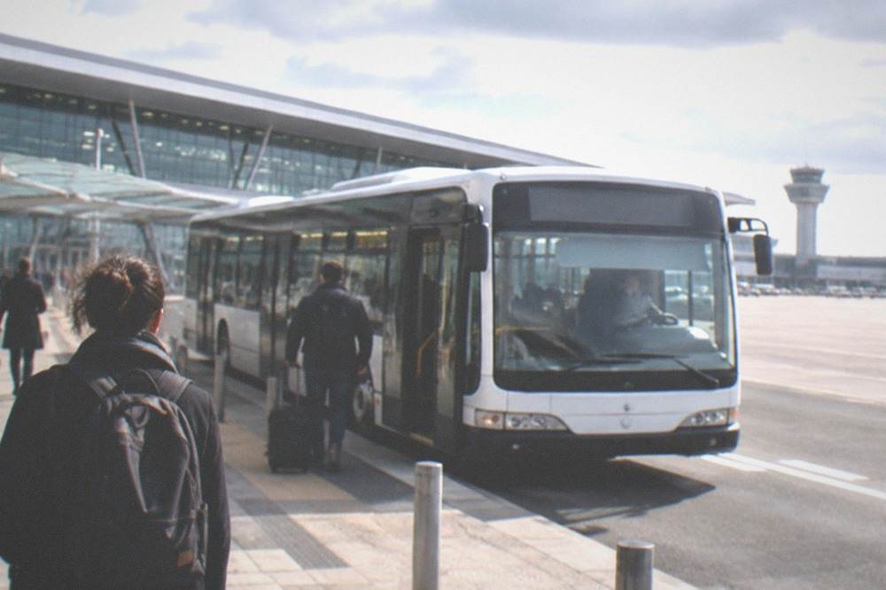
Nantes Atlantique airport, roughly 8 km south-west of the centre according to the airport's own travel pages, handled 7,189,480 passengers in 2025, and the Navette Aéroport shuttle connects it to the city for €10 in about 20 minutes. By rail, about 24 daily services link Paris Montparnasse, the fastest in around two hours. The airport shuttle is excluded from the weekend free-transport rule and always costs €10.
The airport is the western gateway. Its 2025 total of just over 7.19 million passengers returned traffic to roughly its 2019 level, and the 2026 schedule added new routes including Air Canada's seasonal Montreal service from June 2026, Air Transat to Québec, and easyJet routes to Brussels and Essaouira in autumn 2026. The shuttle runs every 20 minutes from April to October and every 30 minutes from November to March, daily except 1 May, from roughly 4:30 to midnight, and since 30 March 2026 its city stop has been at the Gare routière, quai A, by the Gare Sud side of the station. A €10 shuttle ticket also validates the whole Naolib network for an hour. The transfer is covered step by step on Nantes airport to the city centre, and flight options on flights to Nantes.
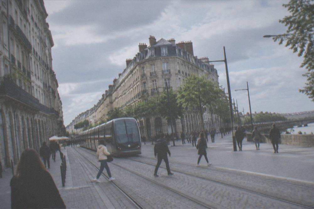
Once in the city, the same Naolib network does the moving: trams on three lines and 45.6 km of track, the busway, the Navibus river crossings, and regional TER trains inside the métropole. A single one-hour ticket is €1.80, a 24-hour ticket is €6.80, and a 24-hour ticket for four people travelling together is €15. The local curiosity worth knowing in advance: all of it is free on weekends, from 00:00 Saturday to 23:59 Sunday, for everyone, with the airport shuttle the sole exception. Details are on getting around Nantes.
| Ticket | Price | What it covers |
|---|---|---|
| Naolib 1-hour ticket | €1.80 | tram, bus, Navibus, TER inside the métropole |
| Naolib 10 × 1-hour | €17.80 | the same, carnet |
| Naolib 24-hour | €6.80 | unlimited network travel for a day |
| Naolib 24-hour, 4 people | €15 | a group of four travelling together |
| Navette Aéroport | €10 | airport shuttle, valid 1 h on the whole network |
How Big Is Nantes?
Nantes is France's sixth most populous commune, with 327,734 residents in the city proper in 2023 and a density of 5,027.4 inhabitants per square kilometre. The wider Nantes Métropole counted 689,456 people in 2023, according to the INSEE figures reported for that year. Growth between 2017 and 2023 ran at 1.0 per cent per year, a pace that has kept Nantes the demographic engine of western France.
The city's weight is metropolitan, not just municipal. INSEE's 2023 publication puts the commune at 327,734 people and the intercommunal métropole at 689,456, with the métropole figure reported rather than directly re-verified by this site. The transport network carries 154 million trips a year, the count Nantes Métropole itself publishes for 2024, and the urban form that carries them is compact enough that most of a visit happens within a triangle bounded by the station, the château and the Île de Nantes. Nantes was named a European Green Capital in 2013, and Time magazine had already called it the most liveable city in Europe in 2004, a quote the European Commission's own award page still carries.
| Measure | Figure | Year |
|---|---|---|
| Commune population | 327,734 | 2023 |
| Population density | 5,027.4 per km² | 2023 |
| Métropole population | 689,456 (reported) | 2023 |
| Annual growth | 1.0% per year | 2017-2023 |
| Naolib trips | 154 million | 2024 |
| National rank | 6th most populous commune | 2023 |
Scale matters for planning more than for trivia. A city of this size, dense and tram-served, behaves like a walking city with a rail spine: the distances between the sights on the itinerary pages, from one day in Nantes to three days in Nantes, are short, and the question of is Nantes a walkable city gets a yes on the evidence of the compact centre. The decisions that follow are about depth, not distance, which is where the private walking products and the photography walk below come in.
Why Did Nantes Grow Exactly Where It Did?
Nantes stands where three rivers meet: the Loire gave it ocean access, the Erdre gave it inland Breton trade, and the Sèvre Nantaise drained the vineyards to the south. The gothic cathedral was begun in 1434, Francis II began rebuilding the ducal château in 1466, and the port made Nantes France's leading slave-trading city from the mid-17th century until it withdrew in 1830.
The site is a textbook river-city location, chosen for what the water could carry. Ocean ships reached the quays into the modern era, and the city's wealth compounded on that reach: sugar, then the triangular trade, then shipyards and the LU biscuit factory, which Jean-Romain Lefèvre started as a Nantes biscuit maker in 1846 and which marked its 180th anniversary in 2026. The cathedral's 457-year construction, begun in 1434 and completed in 1891, tracks the whole arc, and its partial reopening on 27 September 2025 after the 2020 arson fire, with full reopening planned for 2028, is the current chapter of it.
| Year | Event on this site |
|---|---|
| 1434 | Gothic rebuild of the cathedral begins, completed 1891 |
| 1466 | Francis II begins rebuilding the Château des ducs de Bretagne |
| 25 January 1477 | Anne of Brittany born at the château |
| April 1598 | Edict of Nantes signed by Henri IV at the château |
| mid-17th c. to 1830 | Nantes the leading French slave-trade port: 1,714 expeditions, 43% of the French total |
| 1846 | LU biscuit maker founded in Nantes |
| 1915 | The city acquires the château; its museum opens in 1924 |
| 30 June 2007 | Les Machines de l'île inaugurated with the Grand Éléphant |
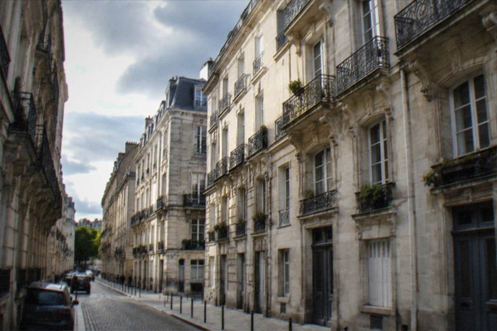
Geography kept paying long after the dukes. The Île Feydeau merchant mansions, built on the port island where Jules Verne was born in 1828, are the architecture of that wealth, and their stones are one of the first things a walk through the old town shows you. The later layers, from the 1985 return of the tram, France's first modern network, to the shipyard island turned over to mechanical elephants, all sit on the same bend of the same river.
Where Does Nantes Sit In The Wider Region?
Nantes anchors the eastern end of an estuary corridor that runs west to Saint-Nazaire, with the Muscadet vineyards to the south-east, the château-and-vineyard town of Clisson to the south, and the Atlantic resorts of La Baule and Le Croisic under an hour away by TER. The Loire-Atlantique department as a whole wraps the city in coast, marsh and wine country, all reachable on the same regional rail network.
The department's geography sorts into four belts around the city. West is the estuary and coast: Saint-Nazaire with its Escal'Atlantic liner museum, and the beaches beyond. South is the salt and wine country: the medieval walls of Guérande, its 2026 salt harvest reported as an exceptional double crop, and the Muscadet appellation whose vineyards climb the Sèvre valley. South-east sits Clisson, Italianate and castle-crowned, the shortest rail hop in the table above. North-east the Erdre country and the road towards Angers and the classic Loire châteaux begins; the planning for that route is on the Loire Valley châteaux page.
Practically, this makes Nantes a base city rather than a drive-through. The question of where to stay in Nantes and the answer to is Nantes worth visiting both hinge on the same fact: you can sleep in a city with a tram, a river port's worth of food culture, and a station that puts beaches, vineyards and châteaux within a day return. That combination, more than any single sight, is what the city's map position buys.
Common Questions About Where Nantes Is
Where exactly is Nantes in France?
Nantes is in western France, the prefecture of the Loire-Atlantique department in the Pays de la Loire region, on the Loire river where the Erdre and the Sèvre Nantaise join it. It is France's sixth most populous commune and roughly two hours from Paris by TGV.
Is Nantes in Brittany or Pays de la Loire?
Both, depending on which map you hold. Historically Nantes was a principal city of the dukes of Brittany and Anne of Brittany was born at its château in 1477. Administratively, since the decree of 30 June 1941, the Loire-Atlantique department has been separated from the Brittany region and the city is governed as part of Pays de la Loire.
How far is Nantes from Paris?
About two hours by direct TGV from Paris Montparnasse, with around 24 daily services each way and the fastest connections in roughly two hours and five minutes. It is one of the most accessible major cities in western France by rail.
How far is Nantes from the ocean?
The Atlantic is close by regional train: Saint-Nazaire at the Loire's mouth is about 33 minutes away and 64 km by rail, the beach resort of La Baule about 51 minutes, and the fishing port of Le Croisic about 1 hour 3 minutes.
Which airport serves Nantes?
Nantes Atlantique, roughly 8 km south-west of the centre per the airport's own travel pages, which handled 7,189,480 passengers in 2025. The €10 Navette Aéroport shuttle runs about every 20 minutes from April to October and every 30 minutes from November to March, taking roughly 20 minutes.
What rivers run through Nantes?
The Loire runs through the city on its way to the Atlantic, joined from the north by the Erdre and from the south by the Sèvre Nantaise. The Erdre's banks hold the Île de Versailles Japanese garden and the cruise boats; the Sèvre drains the Muscadet vineyard country.
Knowing where Nantes is, in the end, is knowing what it is close to: a two-hour rail line to Paris, an estuary to the Atlantic, vineyards up every southern valley, and a compact, tram-served city at the centre of all of it. That position is the city's oldest asset and the best argument for making it your base in western France, whether you come for a weekend, a green-line art walk, or a full circuit of the Loire's mouth.