Is Nantes A Walkable City?
Is Nantes a walkable city? A direct answer with verified transport, climate and neighbourhood facts for planning a walking trip to Nantes in western France.
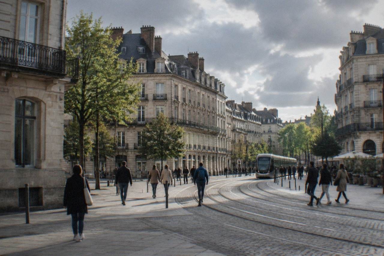
Nantes, in the Loire-Atlantique department of the Pays de la Loire region of western France, is a city built around the idea that people move on foot. The historic core between the Château des ducs de Bretagne and the Graslin quarter is compact, largely pedestrianised and stitched together by the Loire and Erdre rivers. Even the parts that feel far apart, such as the Île de Nantes across the water, sit within an easy stroll of the centre. The short version: yes, this is a walking city, and one of the better ones in France for it.
Is Nantes A Walkable City?
Yes, Nantes is a genuinely walkable city. The historic core, from the Château des ducs de Bretagne through the Bouffay old town to the Graslin quarter and the Passage Pommeraye, is compact enough to cover on foot in a day, and much of it is pedestrianised. The Voyage à Nantes green line paints a roughly 20 km walking route onto the pavement, and the Île de Nantes across the Loire extends the walkable area.
That is the headline answer, but the details are what make the difference between a good walking city and a frustrating one. Nantes earned the European Green Capital award in 2013, in part for exactly this kind of planning, and the honour still shapes how the streets treat pedestrians. The city earns its walkability in three ways: the sheer density of sights in the centre, a transport network that fills every gap walking cannot, and a climate that rarely makes walking unpleasant for long.
The question also matters for how you plan the trip. If you are weighing up how many days to spend in Nantes, the answer partly depends on whether you can cover the centre on foot. You can. Two full days of walking will take in the château, the cathedral, the Bouffay, the Passage Pommeraye, the Île de Nantes and the Machines de l'île, with time left for a riverside detour.
How Compact Is The City Centre?
The core of Nantes fits comfortably within a 20 to 30 minute walk in any direction from the Château des ducs de Bretagne. The Bouffay old town, the cathedral, the Passage Pommeraye, Place Royale and the Graslin quarter all sit inside that circle, and traffic-limited sectors completed in 2025 around rue de l'Hôtel de Ville and south of the cathedral have pushed the pedestrianised area further. The free château courtyard and ramparts give a walker a full circuit without touching a road.
Density is the thing. Consider what sits within a short stroll of one another: the Château des ducs de Bretagne, whose courtyard and ramparts are free to walk daily from 8:30 to 19:00; the Cathédrale Saint-Pierre-et-Saint-Paul, which partially reopened on 27 September 2025 after the 2020 fire, with full reopening planned for 2028; and the Passage Pommeraye, the 1843 shopping gallery that the official Voyage à Nantes site describes as unchanged since it was built. None of these requires transport to reach from any of the others.
The pedestrianisation is not cosmetic. Nantes Métropole has extended its traffic-limited and pedestrian zones through the Bouffay district in phases, with sectors around rue de l'Hôtel de Ville, Joffre and the streets south of the cathedral completed through 2025. The practical effect for a visitor is simple: the routes between the main sights are increasingly streets designed for feet rather than wheels.
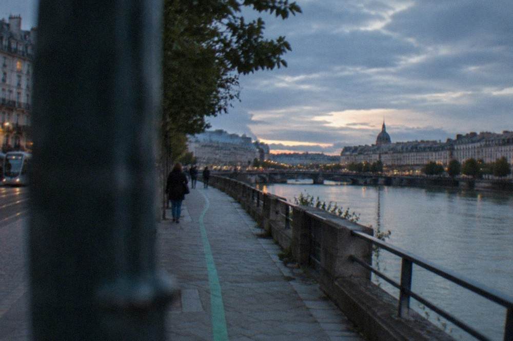
The green line deserves its own mention. Le Voyage à Nantes, the body behind the city's art programme, maintains a painted green trail across the city; its own site describes all 22 kilometres of it. It exists primarily to guide visitors past permanent artworks and sites, but a walker can treat it as a free, self-guided route through districts they might otherwise miss. A 2026 maintenance report put the repainted length at 20.5 km, so roughly 20 km is the honest figure to carry in your head.
For a first visit, a structured walk is a reliable way to absorb the layout before striking out alone. The 35-stop self-guided app tour below covers the city centre at your own pace, and pairs well with a second day of independent wandering.
Which Nantes Neighbourhoods Are Best On Foot?
The Bouffay old town, the Graslin quarter, the Île Feydeau and the Île de Nantes are the four most rewarding districts for walking in Nantes. Bouffay and Graslin form the pedestrianised historic core; the Île Feydeau sits just across the Erdre with the facades of its merchants' houses, including the quarter where Jules Verne was born in 1828; and the Île de Nantes, home to the Machines de l'île, is a longer riverside walk but still reachable on foot from the château.
Trentemoult, across the Loire, needs the Navibus ferry rather than a bridge.
Each district rewards a different kind of walk. The table below sets out what each one offers a pedestrian, using only what the site's verified facts support.
| District | What a walker finds there | Getting there on foot |
|---|---|---|
| Bouffay old town | Cathedral (partially reopened 2025), medieval streets, pedestrianised sectors extended through 2025 | Core of the city; start anywhere |
| Graslin quarter | Passage Pommeraye (1843), Place Royale, Théâtre Graslin | 5-10 minutes west of Bouffay |
| Île Feydeau | Merchants' house facades, Jules Verne's birthplace at 4 rue Olivier-de-Clisson from 1828 | Directly north across the Erdre from the château |
| Île de Nantes | Machines de l'île, Hangar à Bananes bars and galleries | Riverside walk south across the Loire bridges |
| Trentemoult | Fishing-village lanes and coloured houses in Rezé | Navibus N1 ferry from Gare Maritime, not a walk |
Two of these deserve the walking time. The Île Feydeau carries the city's trading wealth in its facades; the facts pack records the writer Jules Verne was born there in 1828 at 4 rue Olivier-de-Clisson, and the island's streets still show why. The Île de Nantes is the newer walk: the Machines de l'île opened on 30 June 2007 with the Grand Éléphant, and the Galerie des Machines and Carrousel des Mondes Marins each cost 12 EUR full price per the official tariff page, with 2-attraction day packages at 20 EUR and 3-attraction packages at 29 EUR.
If you would rather fold the walking into food or a day out, the picks below cover a guided old town food walk and a salt-marsh day trip to Guérande, both of which assume a comfortable amount of time on your feet.
The one caution for riverfront walkers: the Loire floods. In February 2026 the river reached 8.18 m at the Pont Anne-de-Bretagne, the first time it exceeded 8 metres in about 15 years, and the Mémorial de l'abolition de l'esclavage, which sits on the Quai de la Fosse, closed during the flooding as its practical-info page states. Winter walks along the quay are fine in normal conditions, but check the situation if there has been heavy rain upstream.
Does The Weather Suit Walking In Nantes?
Nantes has a temperate oceanic climate, not a Mediterranean or continental one, and it suits walking for most of the year. Météo-France's 1991-2020 normals for the Nantes-Bouguenais station give mean maximum temperatures from 9.3 C in January to 25.4 C in August, with 819.5 mm of rain a year spread across 119.7 days. The wettest month is December and the driest is July, so summer walks are drier, autumn and winter ones damper but rarely blocked.
The numbers matter because walkability is a weather question as much as a street-layout question. The table below gives the monthly means a walker actually feels, drawn from the verified Météo-France normals.
| Month | Mean max C | Mean min C | Rain days (1 mm or more) |
|---|---|---|---|
| January | 9.3 | 3.4 | 12.5 |
| April | 16.2 | 6.6 | 9.7 |
| July | 25.1 | 14.3 | 7.1 |
| October | 17.6 | 9.5 | 11.8 |
The pattern is steady rather than extreme. Frost days average 29.1 a year, concentrated in January and February, and the normals show only 11.8 days a year reaching 30 C or above. That said, 2026 rewrote the record book: the station's all-time high is now 42.2 C, set on 24 June 2026, and the city recorded 40 days at or above 30 C that year. If you are walking in June or July, plan the riverside stretches for the morning. Visitors comparing the climate with other parts of the country can read more about whether it rains a lot in Nantes and the coldest month in Nantes.
Do You Ever Need Public Transport In Nantes?
Occasionally, yes. The tram network of three lines covering 45.6 km and 84 stations fills every gap a walker cannot, a single one-hour Naolib ticket costs 1.80 EUR, a 24-hour ticket costs 6.80 EUR, and the entire network is free for everyone on weekends. The Navibus river ferries cross the Loire and the Erdre on ordinary tickets, including the N1 to Trentemoult and the N3 along the Erdre. The only significant exception is the airport shuttle, which always costs 10 EUR, weekends included.
In practice, a visitor based in the centre can walk nearly everything and reserve the tram for three situations: reaching the Machines de l'île on a hot day, returning from Trentemoult after dark, and the trip to or from the airport. The fare structure, all verified from Naolib's own tariff page, looks like this.
| Naolib ticket | Price | What it covers |
|---|---|---|
| 1 hour | 1.80 EUR | Tram, bus, Navibus and TER inside the métropole |
| 10 x 1 hour | 17.80 EUR | Carnet of ten single tickets |
| 24 hours | 6.80 EUR | Unlimited network travel for one person |
| 24 hours, 4 people | 15 EUR | Group day ticket |
| Airport shuttle | 10 EUR | Station to airport, always charged, weekends included |
The weekend rule is the detail that surprises people. Naolib's tariff page states the network is free on Saturdays and Sundays from 00:00 to 23:59, a policy in place since 2021, and that the airport shuttle is excluded from it. So a walking itinerary that plans the longest legs for a weekend is a walking itinerary with a free escape hatch.
For the airport itself, the shuttle runs every 20 minutes from April to October and every 30 minutes from November to March, taking roughly 20 minutes between the station and the terminal, per the airport's own shuttle page. Full planning for arrival is on the Nantes airport to city centre guide.
If you intend to walk the centre with structure rather than freestyle, the self-guided app tour is the natural companion: 35 stops, self-paced, and no group timetable to keep. For travellers who prefer a longer structure, the Nantes Travel Guide homepage collects the main walking itineraries in one place.
Common Questions About Walking In Nantes
Is Nantes a walkable city?
Yes. The historic core around the Château des ducs de Bretagne, the Bouffay old town and the Graslin quarter is compact and largely pedestrianised, the Voyage à Nantes green line paints a roughly 20 km walking route across the city, and the Île de Nantes extends the walkable area across the Loire. Nantes was the European Green Capital in 2013, and its street design still reflects that.
Can you walk everywhere in Nantes without a car?
Almost. Everything in the centre, the Île Feydeau and the Île de Nantes is walkable, and the tram and Navibus ferries cover the rest, including Trentemoult across the Loire, which has no walking bridge from the centre. A car is a hindrance in the pedestrianised core, and the airport shuttle costs 10 EUR each way, so even arrival and departure do not need one.
How long does it take to walk across central Nantes?
The core sights, from the château to the Graslin quarter and the Passage Pommeraye, sit within a 20 to 30 minute walk of one another, and a full walking day covers the château, cathedral, Bouffay, Passage Pommeraye and the Île de Nantes. The green line route, at roughly 20 km end to end, is a multi-day project rather than a single stroll.
Is Nantes flat enough for easy walking?
The site's verified facts do not give a terrain profile for the city, so no figure is offered here. What the facts do show is the transport fallback: three tram lines over 45.6 km with 84 stations, Navibus ferries on the Loire and Erdre, and free weekend travel on the whole network, so any walk that turns out longer than planned can be cut short without cost on a Saturday or Sunday.
When is the best time of year to walk in Nantes?
Summer is the driest walking season: July averages 7.1 rain days and a mean maximum of 25.1 C, per the 1991-2020 Météo-France normals. But June 2026 set a new all-time record of 42.2 C, so extreme heat is now a real possibility in high summer. Spring and early autumn offer mean maxima in the high teens and fewer frost days than winter, making them comfortable for long walking days.
Is the Nantes green line a real walking trail?
Yes. Le Voyage à Nantes paints a green line across the city's pavements to guide walkers past its permanent artworks and sites; its own site describes all 22 kilometres of it, and a 2026 maintenance report repainting 6.3 km of it confirms the trail is actively kept up. It is free to follow and works as a self-guided route through districts beyond the obvious centre.